Discover the Merced River Beyond the Rapids
Posted April 25, 2024 by Lenka Bostian
Have you ever wondered what lies above and/or below the whitewater section of the river you raft on? Do you know if the water you are dipping your paddle in came from the bottom of a reservoir, or whether it was snow a couple of days ago? Similarly, do you know where the river continues past the take-out spot of your whitewater adventure? Are there other recreation opportunities along the same river besides rafting? In this post, we’ll take a closer look at the Merced River watershed. This springtime rafting favorite offers many other possibilities besides whitewater action along its 145-mile course.
Merced River Headwaters
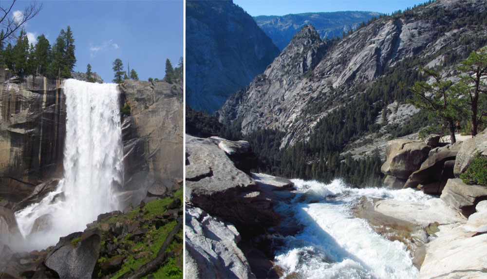
The headwaters of the Wild and Scenic Merced River lie below the highest peaks of Yosemite National Park at an elevation of over 8000 feet above sea level. Four main forks combine to form the Merced River: Red Peak Fork, Merced Peak Fork, Triple Peak Fork, and Lyell Fork. In the summertime, seasoned backpackers can hike along the small stream, visiting and swimming in Merced Lake and Washburn Lake – a pair of naturally created alpine lakes in the Yosemite high country. The small river collects a handful of tributaries as it heads further downstream through glacially polished granite bedrock. Within a day-hike distance from Yosemite Valley, the river creates both the majestic Nevada and Vernal Falls on its way down to the popular hub of the whole national park.
The world-famous Yosemite Valley
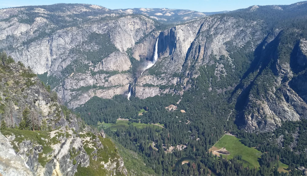
After cascading down giant boulders along the steps of the famous Mist Trail, the Merced River picks up Illilouette Creek before arriving at Yosemite Valley. A well-frequented Mirror Lake Trail parallels yet another tributary, the Tenaya Creek. The river meanders through the valley’s expansive meadows, contributing to the picturesque views. It is here where you can first take a ride on its slow current, river flow conditions permitting. Bring your own inner tube or rent a raft from the local National Park concessionaire. The self-guided float is about 3 miles long and while there are no rapids and no whitewater on this stretch, it is a nice relaxing way to take in the majestic vistas. The Merced River picks up a handful of tributaries, such as Yosemite Creek (via Yosemite Falls, one of the tallest waterfalls in the US) and Bridalveil Creek (via Bridalveil Falls) before exiting the National Park on the west.
Whitewater Rapids Galore
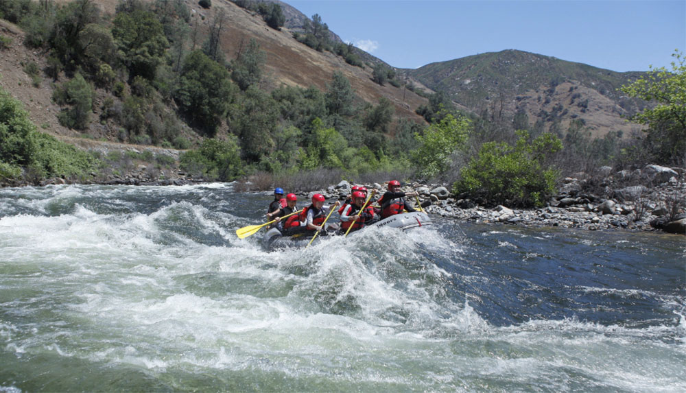
Entering the rolling Sierra Foothills landscape near El Portal, the Merced River’s gradient mellows, turning the next several-mile stretch into a whitewater paradise. As there are no reservoirs upstream regulating the amount of water in the river, the flows solely depend on the rate of snowmelt upriver. Typically, by mid-April, temperatures in the high country stay above freezing more consistently, and the longer days provide enough sunshine to kickstart the spring melt. The Merced River rafting season begins, allowing both experienced and novice rafters to take on the fun, rolling Class 3 and 4 rapids starting in the town of El Portal. For several miles, the whitewater section parallels the two-lane Highway 140, which is one of the four main roadways leading to Yosemite National Park.
At the community of Briceburg, the South Fork of the Merced River adds a significant amount of water. The road turns south toward the town of Mariposa while the river continues westward through a wilderness canyon. The exciting rapids continue, and depending on the flow levels, rafters either end their trip at the Railroad Flat take-out, or continue on the Quarter Mile section downstream. The North Fork of the Merced River joins in just below the North Fork Falls portage (Class 6 rapid). It is the last noteworthy tributary before the river arrives at Lake McClure’s Bagby Recreation Area.
Water Recreation at Lake McClure and Lake McSwain
After 122 miles of running freely without any artificial obstruction, the Wild and Scenic designation of the Merced River ends. The New Exchequer Dam built in the 1960s impounds the river flow just before it arrives at California’s Central Valley. The captured water is used mostly for agricultural irrigation and hydroelectric power production. The created Lake McClure, along with the smaller regulating reservoir just downstream – Lake McSwain – offer a host of recreation opportunities.
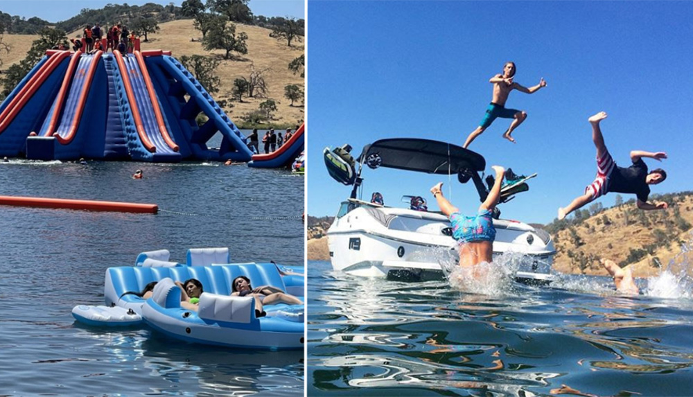
There are several day-use areas and campgrounds (tent and RV camping as well as cabins) around the perimeter, along with miles of trails for hiking and mountain biking. Both reservoirs are known for excellent fishing and are popular for catching trout, bass, and salmon. The expansive Lake McClure is a great boating location, complete with multiple marinas and even launch ramps for water skiers. Rentals are available. The Splash-n-Dash Aqua Park on Lake McSwain claims to be North America’s largest floating inflatable waterpark.
The Lower Merced River
Most of Merced River’s precious water is rerouted to irrigation canals and pipelines that supply the vast California farmlands. Only a limited volume is allowed to continue downstream, slowly meandering among green fields, orchards, and vineyards. Typically, a thin ribbon of a river remains by the time it reaches its confluence with the San Joaquin River in the heart of the upper Central Valley.
Along its entire length, the Merced River provides a host of recreation opportunities. From high Sierra hiking routes and cool alpine lakes, to world-famous iconic waterfalls and scenic vistas in California’s most visited National Park. This river is a boater’s paradise! You can enjoy both the powerful and rip-roaring wave trains of the whitewater section (we can help with this part!) as well as the relaxing flat water reservoir-based activities. The Merced is indeed mighty and we encourage you to explore not just its whitewater rapids, but also the rest of its renowned course.
