Explore the American River Trail
Posted June 7, 2024 by Reily Schultz
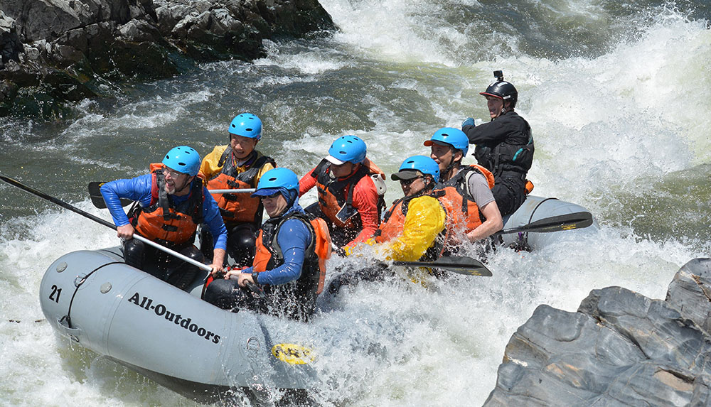
Satan’s Cesspool rapid on the South Fork American River is a crowd favorite for rafters and spectators. This rapid is one of the largest of the day when you raft the Lower Gorge section of the South Fork. There are often photographers perched on the rocks on each side of the river overlooking this rapid waiting to capture the splashes and great facial expressions of rafters plowing through the waves. Want to find a good vantage point to see what they’re seeing? Lucky for you there is a trail that does just that.
The American River Trail- A Melting Pot of Trails
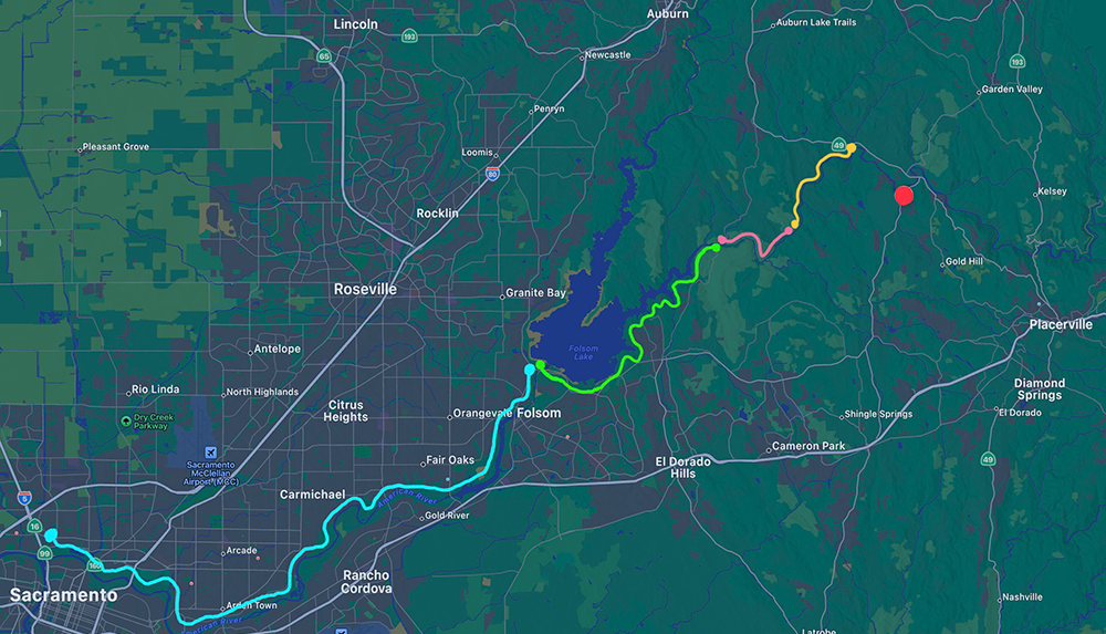
The first section of the American River Trail was completed in 1974, and since then has expanded to a series of trails spanning over 50 miles all the way from Coloma to Sacramento. At its Northernmost point in Coloma, the trail starts off from Greenwood Creek River Access Park as a dirt hiking path that parallels the Northern edge of the South Fork American River. After passing through popular river access areas in Lotus along the way like Magnolia Ranch and Cronan Ranch (a perfect place to stop for lunch on a rafting trip, don’t you think?), you will find yourself at the terminus of the South Fork as it flows into Folsom Lake. Maybe you’ll even get to see some All-Outdoors rafts ending their trip here at the Salmon Falls bridge!
The dirt pathways continue along the South side of the lake for roughly 12 miles as the Brown’s Ravine Trail. Hikers wind along the water and behind neighborhoods as they work their way through a rural corner of El Dorado Hills, then across the dam and down to a more familiar commercial space in Folsom. Once in Folsom the dirt trail transforms into a paved bike path known as the Jedediah Smith Memorial Trail. After a few miles’ walk along the North side of Lake Natoma, the trail crosses back to the Southern side of the American River until it reaches its end in Old Sacramento.
Hike Where You Raft
Construction on the Skunk Hollow section of the American River Trail was started in 2016. This followed community interest and efforts from the American River Conservancy (ARC) to combine several parcels into 2,000 acres of public land. The completion of this trail marked the success of a 16-year process with millions of dollars invested. The ownership of the land along the river banks of the South Fork American River was disputed for years until ARC was finally able to secure and protect the area’s local ecosystem.
A network of trails already spanned from the Greenwood Creek river access point to the far edge of the Cronan Ranch recreation area. Now it was time to connect this beloved map of trails to the larger American River Trail system. This new 9-mile stretch of trail would cut through the newly protected land to connect Cronan Ranch to the Salmon Falls bridge. Following this stretch of single track dirt trail will bring you right past the infamous Satan’s Cesspool rapid. If you time it right (aim for about 2pm during the summer) you may get to see rafters and kayakers run through a couple of rapids!
The Salmon Falls bridge (or Skunk Hollow Trailhead) is the take-out location for rafters on the Lower Gorge run on the South Fork American. It is also the terminus of the most recent addition to the American River trail. The trails immediately surrounding Skunk Hollow are a local favorite. They bring you along a ridge with spectacular views of the river canyon and then right down to the water for a better look at some whitewater.
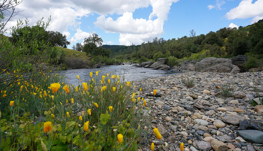
After paying a day-use fee to park, you can choose to travel either West toward the lake or East and upstream along the river. Hiking West will take you along the perimeter of Folsom Lake (brochure and map) on a rolling up-and-down single track trail. Go East and you will find rapids, old redwoods, sandy beaches, and lots of good skipping rocks. As you hike farther, the maze of trails opens up giving you many different options. Feel like climbing to a ridge top? Want to see an abandoned movie set? Hoping for some geo-caching? You’ve got it. Eventually, you can make it all the way to the familiar Coloma-Lotus Valley. Heading West may give you more options as far as the length and duration of your hike and perhaps a few more swimming areas. But trust us, the views and experience from the Eastern section cannot be beaten.
Reily Schultz
Reily is a Gold Country native. She graduated from Willamette University with a degree in Studio Art and a minor in Gender Studies and Psychology. She joined the All-Outdoors family in the spring of 2022, working as a California Rafting Consultant and a member of the marketing team. Her favorite All-Outdoors itinerary is the multi-day Tuolumne rafting trip. Reily is an avid artist, outdoors-woman, and purr-fessional cat snuggler.