What in the World Is Ruck-a-Chucky?
Posted July 25, 2024 by Lenka Bostian
California has its fair share of interesting place names. Among our favorite ones is the small settlement of Rough and Ready located in the gold country just north of the American River, or the town of Whitewater sitting in the middle of the southern California desert. If you’ve rafted on the Middle Fork of the American River, you may remember “Ruck-a-Chucky.” Apart from the fact that it’s pretty fun to pronounce, what does it actually mean? It turns out that while in the same general geographical area, Ruck-a-Chucky (sometimes spelled Rucky Chucky) means different things and specific places to different groups of people.
The Ruck-a-Chucky Portage
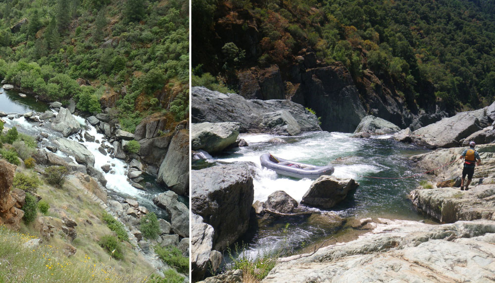
Mention Ruck-a-Chucky to a rafter and they will tell you this is an impressive Class 6 rapid on the Middle Fork of the American River. On the international scale of river difficulty, a Class 6 rapid is categorized as “unrunnable”. Rightfully so, Ruck-a-Chucky Falls is a 30-foot waterfall flanked by huge boulders and it’s quite a sight to behold. On their approach, rafters navigate the fun Class 4 Chunder Rapid just upstream ending in a pool above the falls. Guests disembark their rafts here and walk around the falls (aka “portage”) while guides push the boats over and catch them in the frothy water just below. This is often a highlight of the whole rafting trip, ranking just behind the thrilling ride down the Tunnel Chute Rapid. To a rafter, there is no question that Ruck-a-Chucky is a portage on the Middle Fork American River.
Ruck-a-Chucky River Crossing
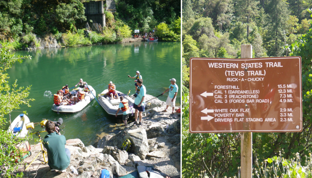
Now, if you told a rafter that athletes and horses ford the Middle Fork American River at Ruck-a-Chucky, she or he might give you a good laugh and consider you nuts. The caveat here is that the “Rucky Chucky” river crossing is at a slightly different spot on the river. Although bearing the same name (with a slight spelling variation), the crossing is located a few miles downstream from the water feature described in the previous paragraph. For rafters, this location marks the end of their Class 3-4 whitewater river trip where they board shuttle busses to complete their adventure. For race participants, this may be one of the most memorable moments in their competition.
The Western States Trail is a historic trans-Sierra route leading from Olympic Valley near Lake Tahoe all the way to Auburn, CA. The 100-mile trail traverses remote ridges and canyons through the Granite Chief Wilderness and the National Forest lands. Near Foresthill the trail dips toward the river and parallels the Middle Fork American for several miles before crossing it at Rucky Chucky.
Each year two separate world-famous endurance race events take place on this trail. During the Western States Endurance Run, ultramarathon distance runners either use outstretched guide ropes to cross the river on foot or, in big snowpack years, they take a short boat ride to reach the other side. All-Outdoors is proud to support the event providing rafts, guides, and life jackets for the athletes. The Tevis Cup is an endurance ride pre-dating the running event where horses and their riders use the same route, getting across the river at the Rucky Chucky river crossing. In high water years, the Tevis Cup course is re-routed…we do not ferry horses on the rafts!
The Ruck-a-Chucky Bridge That Never Happened
River guides sometimes refer to the Middle Fork take-out spot as the “Greenwood Bridge site.” A bridge at the spot where the Western States Trail crosses the river makes perfect sense, right? So why isn’t there one, you may ask? The Greenwood Bridge used to connect the Placer and El Dorado Counties at this exact spot. It was destroyed and swept away by a huge flood caused by the Hell Hole Dam collapse in December 1964. While the Hell Hole Dam on the Rubicon River (tributary to the Middle Fork) was rebuilt a few years later and still stands today, the bridge never did.
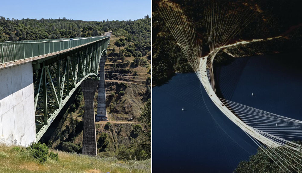
A new project, the Auburn Dam, was planned at the time, slated to create a reservoir that would inundate the area of the original Greenwood Bridge. Designs for a futuristic-looking new bridge, called the Ruck-a-Chucky Bridge were completed. It was meant to sit high above the valley filled with reservoir water, but as the Auburn Dam plans got halted, this replacement bridge was never built. Another nearby bridge designed with the future dam in mind, the Foresthill Bridge, had a different fate. It was completed in 1973 and to this date remains the tallest bridge in California. You get to drive across this feat of engineering on your way to our Middle Fork meet place in Foresthill.
Ruck-a-Chucky Campground
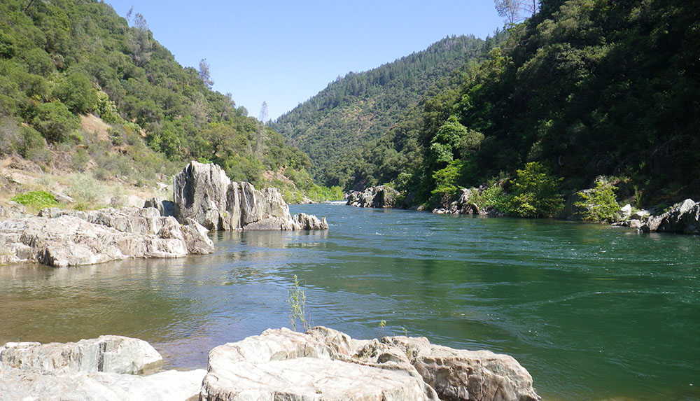
A quick Google search for “Ruck-a-Chucky” may return yet another namesake – a campground in the Auburn State Recreation Area. This small State Park-run camp is located along the Middle Fork American River, just a few hundred yards downstream from the rafting take-out spot and the race river crossing site. The 5 primitive campsites (pit toilets, no running water) operate on a first-come first-served basis and are great for those looking for a remote camping site that offers good fishing and allows dogs. Recreationists – be advised that river levels fluctuate due to regular water releases from reservoirs upstream. Water levels typically go up in the afternoons (bringing river rafters along) before dropping again in the evening.
Now when the rafter, the ultramarathon distance runner, the architectural design buff, and the camper get together and strike up a conversation about Ruck-a-Chucky, it will make a whole lot more sense to everyone around! One thing will remain the same…Ruck-a-Chucky will still be super fun to pronounce – come on, we dare you not to smile when you say it out loud!
