Discover the Middle Fork of the American River Beyond the Rapids
Posted June 19, 2024 by Mathilda Farrell
The Middle Fork of the American River is, as its name implies, the middle of three contributing tributaries to the greater American River. You may have rafted the Class 3 rapids on the South Fork, or heard of the Class 4+ North Fork, but the Class 3-4 Middle Fork flows from a unique and historied watershed between the others.
Headwaters
The headwaters of the Middle Fork lie on the western side of the peaks that ring the California side of Lake Tahoe. As storm systems move in from the Pacific Ocean and pass over the Sierra Nevada mountain range, they often dump mass amounts of rain and snow. Precipitation on the eastern side of the Sierra Nevada mostly flows into Lake Tahoe. Precipitation on the western side flows into rivers that wind down the Sierra Nevada foothills, including the Middle Fork of the American.
Watershed: Granite Chief Wilderness and Desolation Wilderness
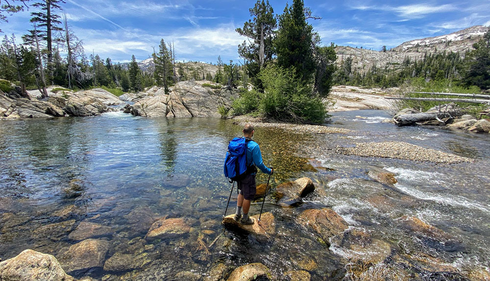
The northern section of the Middle Fork’s watershed starts in Granite Chief Wilderness, on the backside of the popular Palisades Tahoe ski resort where the 1960 Winter Olympics were held. While a snowsport paradise in the winter, Palisades also offers spring skiing and summer activities such as hiking and mountain biking. If you’re looking to extend your rafting adventure, the 9000-ft peaks and beautiful alpine meadows of Granite Chief Wilderness can be visited for backpacking or hiking in the summer months. The southern part of the watershed includes a large section of Desolation Wilderness, a popular destination for backpacking known for alpine lakes and granite bowls.
Reservoirs and Rivers: French Meadows, Hell Hole, and the Rubicon
Four key contributors flow from the upper reaches of the watershed to the main river of the Middle Fork: Duncan Creek, the Rubicon River, Hell Hole Reservoir, and French Meadows Reservoir. French Meadows and Hell Hole are the main two storage reservoirs of the Middle Fork Project, a water supply and hydroelectric project that powers homes in Placer County.
Remote camping is available at French Meadows Reservoir in the summer and the lake can be used for boating and swimming. If you add a visit to French Meadows onto your rafting expedition, know that the most adventurous part of your trip (apart from the whitewater rapids) may be getting to the reservoir as the route includes rough forest roads and no cell service.
The Rubicon River is famous for its annual jeep jamboree and is consequently the namesake for the Jeep Rubicon, a rough-and-tumble, off-roading vehicle. If you prefer exploring on your own two feet, the Rubicon River is also a great, accessible river for day hikes and exploring turquoise swimming holes after rafting the Middle Fork.
Rafting below Oxbow Reservoir
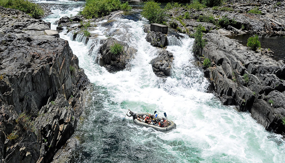
As the water continues to tumble downhill, it gathers into Oxbow Reservoir and is released from the dam into the popular 17-mile rafting stretch of the Middle Fork below. This section of the river canyon is bracketed by two old gold mining towns still in existence today: Foresthill and Georgetown. Middle Fork rafters begin their adventure in Foresthill, a town best known (at least in the AO rafting community) for Worton’s Market, an excellent deli and grocery store, and for surviving California’s largest wildfire of 2022.
Understanding the rapids on this Class 3-4 section of the Middle Fork is inseparable from learning the gold mining history that has shaped the river canyon from the mid-1800s until today. Originally the home of the Nisenan and Maidu Native Americans, the steep, forested Middle Fork canyon was quickly encroached upon by miners after gold was discovered on the nearby South Fork of the American in 1848. This began a progression of mining endeavors from panning, to hydraulic mining, to diverting the entire river through a dynamited tunnel, which irreparably changed the course of the river ecosystem. This unique mining history is in part responsible for making the Middle Fork the iconic rafting river it is today. Read about the Tunnel Chute Rapid to learn more.
Wild and Remote River
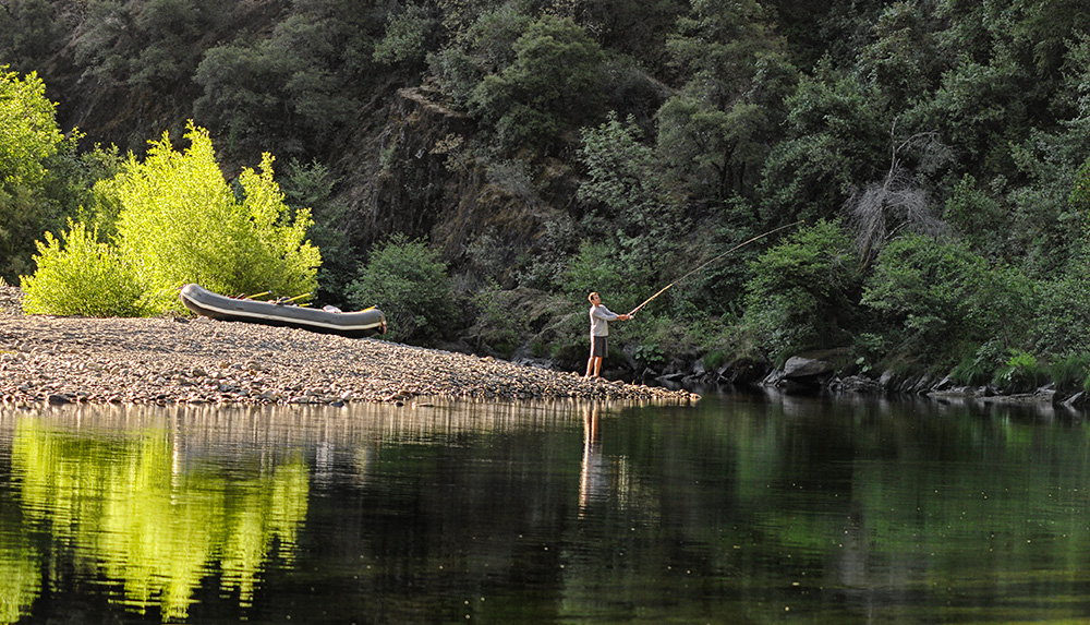
The Middle Fork River canyon’s impressive remoteness can often make you feel like you are truly out in the wilderness. Be on the lookout for bear, otter, osprey, and schools of trout. If you’re a fisherperson joining us on a multi-day rafting trip, consider bringing your pole! Look up at the sky on an overnight trip and enjoy the canyon’s bowl-like effect of brilliant stars – most times you can even see the Milky Way!
The Middle Fork provides rafters the chance to experience all the best parts of rafting. It starts with an action-packed Class 4 section, continues with a lush and idyllic Class 2 section, and finishes with yet another exhilarating Class 4 section. This setup is ideal for a 2-Day or a 3-Day rafting trip, but even a 1-Day trip allows you to get a glimpse into this wild and historic river canyon.
Activities Uphill and Farther Downstream
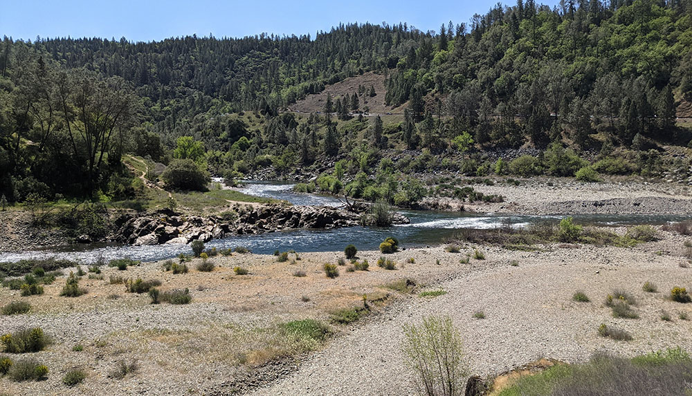
Most river trips end at the Greenwood Bridge Site, another public access point to the Middle Fork for day hiking and picnicking, and also the crossing point of the famous Western States Trail. The Western States Trail runs from Tahoe to Auburn and is the route of both a famous 100-mile foot race and the Tevis Cup equestrian race. After Greenwood Bridge, the river continues through a Class 2 section before coming upon an unrunnable Class 6 rapid named Murderer’s Bar – the reason most rafters don’t venture farther – and eventually joins the North Fork of the American at the Confluence close to the town of Auburn on Highway 49.
The Confluence is a busy destination to see the river, but it is not the best or the safest for swimming. The second half of the rafting section and the Confluence are located in Auburn State Recreation Area. This land was originally condemned to be under reservoir waters created by the unbuilt Auburn Dam and is now a well-loved and well-used recreation area for surrounding towns. Instead of swimming at the Confluence, hike further upstream along the North Fork and check out Clark’s Hole, or go for a hike or bike ride on the Foresthill Divide Trail. If you’re more interested in a good slice of pie or exploring another historic gold mining town, stop in Auburn after your whitewater rafting adventure.
Come raft the Middle Fork!
As the Middle Fork merges with the North Fork and eventually meets the South Fork in Folsom Lake, the 62-mile river’s journey comes to an end. From the peaks to the foothills, the Middle Fork is a quirky river of stunning natural beauty and an excellent example of how human history is natural history. The Middle Fork has and always will be deeply tied to the people in and around the canyon – and those who raft it! Come and discover it for yourself!

Mathilda Farrell
Mathilda has been guiding with All-Outdoors since 2021. Born and raised in San Diego and Eastern Canada, she graduated with degrees in Environmental Science, Policy and Management, and Geography from U.C. Berkeley. Before working as a raft guide, she was a researcher for a healthcare technology start-up in San Francisco and was involved in various public health research projects. When she’s not guiding or writing for All-Outdoors in the summers, she enjoys surfing, reading and writing, and exploring the world around her.