Discover the South Fork American River Beyond the Rapids
Posted August 23, 2024 by Lenka Bostian
The South Fork of the American River is the most popular whitewater rafting destination west of the Mississippi River. Each season, thousands of visitors get familiar – some more intimately than others – with world-famous rapids like Troublemaker and Satan’s Cesspool. Many California fourth-graders visit the town of Coloma, home to the Gold Discovery site where the Gold Rush of 1849 began. But how much do the kids panning for gold at the river’s edge, or the rafters splashing each other in water fights, know about the river’s origins? Are there other ways to enjoy the same water further upstream or downstream? Let’s find out!
Headwaters of the South Fork American: Desolation Wilderness
The entire American River watershed is vast, covering around 2,000 square miles. It collects snowmelt and rainfall from the slopes of the Sierra Nevada west of Lake Tahoe, roughly between Highway 50 and Interstate 80. Much of the northern portion drains into the Middle Fork watershed while the southern part becomes – yes, you guessed it – the South Fork American River.
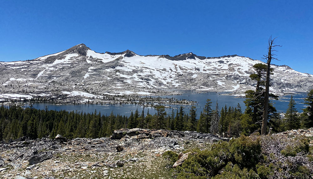
The source of the South Fork is located near Echo Summit, right where Highway 50 makes that big sweeping turn before heading downhill toward Lake Tahoe. If you ever go skiing at Sierra-at-Tahoe ski resort located a few miles west, some of that snow might just become the whitewater you raft on once it melts! This area is a favorite among hikers and backpackers, and for good reason. The scenic Pacific Crest Trail and the lake-circling Tahoe Rim Trail overlap here, offering a variety of distances for those eager to explore the alpine wilderness.
While it is easy to find a backpacking route here, most hikers opt for a section hike on one of these famous trails, or a day hike in the rugged Desolation Wilderness. The name may sound intimidating, but this place is simply a protected area with incredible natural features. The Wilderness starts around the northern edge of Echo Lake, a small community accessible just off the highway. The Upper and Lower Echo Lakes have many recreation options – boating, swimming, and kayaking are popular here. There is even a water taxi that shuttles visitors across the lake, making these views accessible to more people. From this trailhead, hikers have plenty of options. Lake Aloha is a local favorite, with a challenging ascent and beautiful views.
A web of tributaries
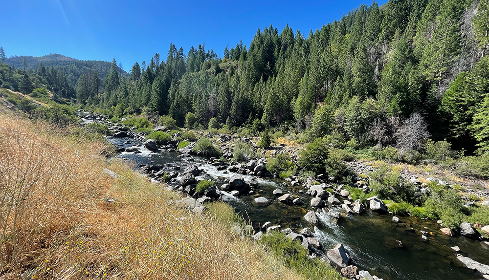
Driving up to Tahoe on Highway 50 through the forested sections near Kyburz, you parallel the young South Fork for a good few miles. When the flow levels are just right (spring or early summer), the lively rapids draw in experienced kayakers and occasionally even rafters, though commercial rafting companies don’t use this section of the river. Near the community of Fresh Pond, the river leaves the sight of the highway and heads northwest, eventually arriving at Slab Creek Reservoir.
Much of the water that powers the South Fork’s Class 3 rapids downstream comes from the major tributary of Silver Creek. This river forms from a web of smaller tributaries originating in Desolation Wilderness within the El Dorado National Forest. Spanning over 63,000 acres, this vast wilderness area captures an immense amount of precipitation, funneling it through its numerous alpine lakes and streams to feed Silver Creek and its reservoirs.
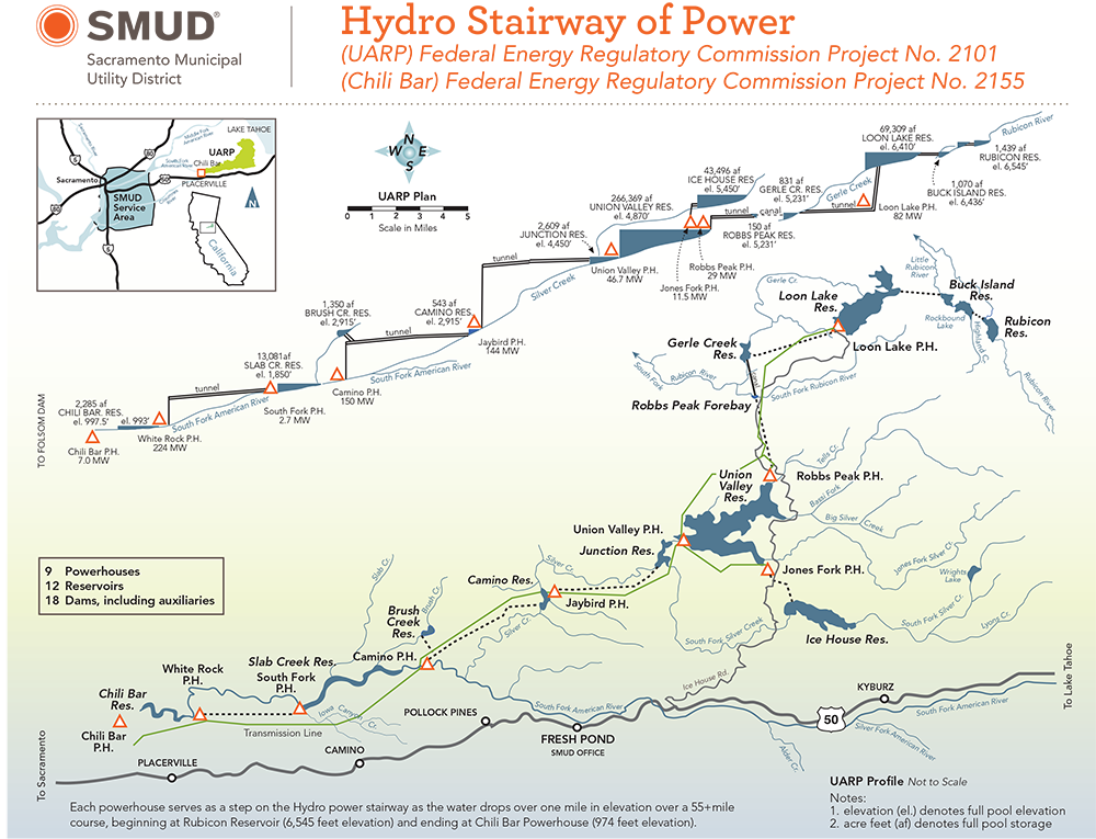
Upper American River Project
Similar to many other significant rivers in the West, the American River has undergone extensive damming and diversion for hydroelectric power generation and water storage. Managed by the Sacramento Municipal Utility District, the Upper American River Project (UARP) is a vital resource for the greater Sacramento region. It contains 12 reservoirs and nine powerhouses, most of which are located on the South Fork and its tributaries. By the time you put in for your whitewater rafting trip, the water you are sitting on has generated lots of clean electricity!
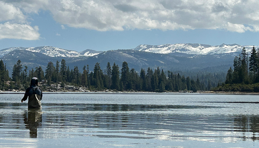
Many of the upstream reservoirs are located within the Crystal Basin Recreation Area and provide excellent recreation opportunities. Ice House Reservoir is easily accessible from Highway 50 with several campgrounds and picnic areas along the shore. Just a few miles north sits the Union Valley Reservoir, the largest water feature in the UARP system. Both lakes are popular destinations for boating (ramps available), camping, and fishing. There are beaches perfect for lounging and swimming, as well as many hiking and biking trails.
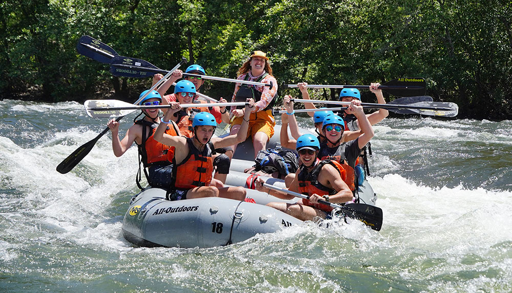
Whitewater Rafting below Chili Bar Reservoir
The last artificial obstruction above the whitewater section of the South Fork American is the Chili Bar Dam. Although it is not part of the Upper American River Project and is managed by PG&E, it works in sync with the upstream reservoirs operated by SMUD to effectively manage the river system. This is important for rafters and kayakers because they can rely on a predictable water release schedule that has been established to ensure consistent and enjoyable river conditions all season long.
As a result, All-Outdoors can provide South Fork American River rafting trips from April to October each year no matter how much snowpack is left after winter. 21 miles of beginner-friendly whitewater offers a variety of itineraries that will fit any schedule. Enjoy it all on a 2-Day river trip, complete with catered meals and an overnight stay at a car-accessible riverside campground. If you only have a day, choose from the Upper “Chili Bar” Section or the Lower “Gorge” Section. Both of these sections offer plenty of fun Class 3 rapids as well as calmer portions for swimming and playing. Rafting on the Lower Section ends at Folsom Lake, where the South Fork meets the North Fork American (which itself is connected with the Middle Fork just a few miles upstream).
Folsom Reservoir and the Lower American River
Whitewater ends at Folsom Lake, but the adventure continues! This reservoir, along with Lake Natoma just below the Folsom Dam, provides a variety of activities for outdoor enthusiasts. Visitors can enjoy boating (motorized or self-propelled), jet skiing, and fishing, with bass and trout being popular catches. Families can relax on the sandy beaches at Granite Bay, enjoy a picnic, or take a refreshing swim in designated areas. The American River Trail follows the southern shoreline of Folsom Lake as a dirt single track, then transforms into a paved bike trail along Lake Natoma and continues downstream along the Lower American River all the way to Sacramento.
The South Fork American River is best known for its exhilarating rapids, and it’s an experience not to be missed. But there’s more to this river than just the thrill of whitewater. From the rugged mountain headwaters and serene high-elevation lakes to the calm waters of Folsom Reservoir, the South Fork invites you to discover a world of adventure, natural beauty, and outdoor activities that go beyond the rapids.
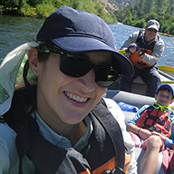
Lenka Bostian
Lenka started working for All-Outdoors in the summer of 2005 when she followed her heart from her native Czech Republic out to California. After graduating college in Prague, she packed up her degree in International Business and moved across the pond for good. She’s been part of the AO family ever since, wearing different hats along the way. Besides trail running, tennis, and traveling, Lenka enjoys rafting and camping on the South Fork with her hubby (former AO guide) and their twin boys.